 DoneThat
The Area around Pen-y-Ghent, Yorkshire, England
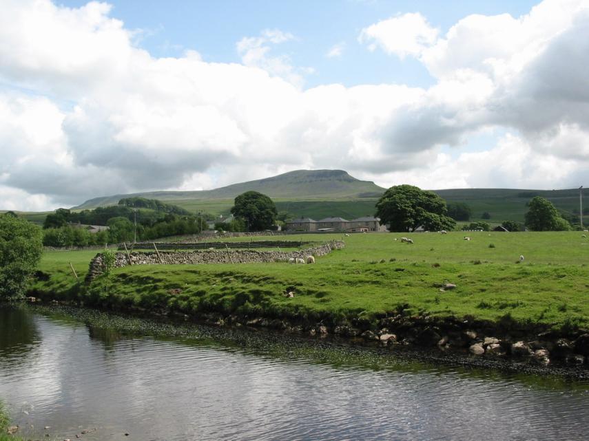
Pen-y-ghent and the River Ribble.
The River Ribble starts life in the Yorkshire dales near Ribble Head, a little North-East of Ingleborough, and follows a meandering 70 mile course into the Irish Sea.
Pen-y-ghent with its distinctive flat top is easily seen on the horizon.
| Comment |
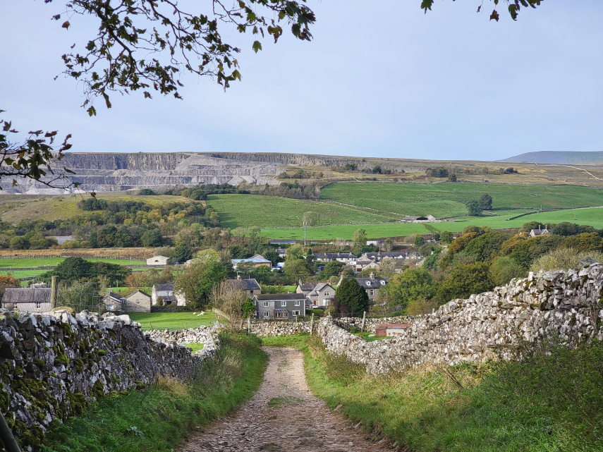
Horton-in-Ribblesdale is a small village, shown in the picture, about halfway between Settle and Ribblehead to the north. There is a National Parks Authority Car Park as well as some free roadside parking.
There are two long distance paths which run through Horton-in-Ribblesdale, the 'Pennine Way' and 'A Pennine Journey'.
We walked up the Pennine Way, shown in the picture, which can take you to the top of Pen-y-Ghent although we didn't go that far.
| Comment | More of Pen-y-Ghent |
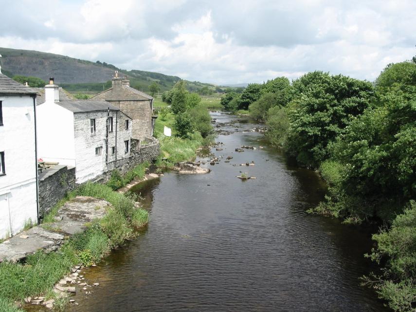
The River Ribble from Helwith Bridge.
Helwith Bridge is about halfway between Horton in Ribblesdale and Stainforth.
| Comment |

Stainforth and the Ribble Valley.
Stainforth, on the right, is a small village 2 miles north of Settle and the other obvious small group of buildings on the left is Little Stainforth.
Stainforth boasts both a Youth Hostel and a waterfall - Stainforth Force.
| Comment |

Stainforth Force is where the Ribble tumbles over a series of steps, in the village of Stainforth, just below the 17th Century Packhorse Bridge. A walk of about a mile will take you to another waterfall - Catrigg Foss.
The Ribble Way, a 70 miles long footpath, traverses this section of the river.
| Comment |
