
 DoneThat
Pen-y-Ghent, Yorkshire, England
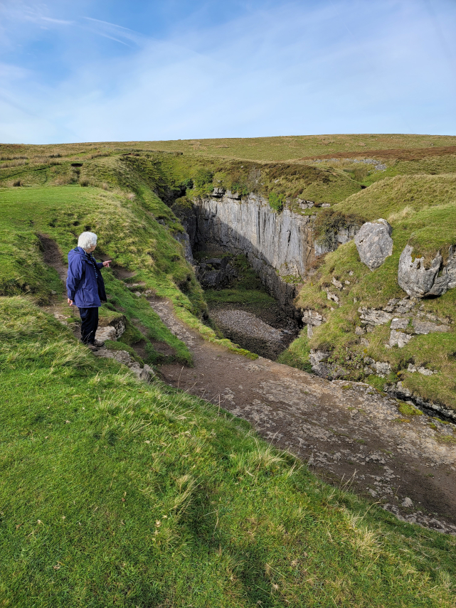
This is the reality. Coming up slope from the left disguises the fact that there is a 60 foot gap between the grass edge and the limestone cliff beyond.
This is Hull Pot which at 60 feet wide, 60 feet deep and 300 feet long is the largest natural opening in England. It is supposed that it has been caused by a cavern roof collapsing and there are no known accessible cave passages although, even when the river bed is dry, there is still water flowing into the pot lower down.
| Comment |

Another view of Hull Pot with Penyghent showing in the background.
The very small figure of Amanda, about a third of the way down the picture on the left, gives the scale. The water from this pothole is known to emerge down near Horton-in-Ribblesdale.
This is not a feature that you would want to stumble on in poor visibility
| Comment |

We re-traced our steps back to the crossroads where we turned onto this path that goes up to the Pen-y-Ghent ridge although we weren't going that far.
We were heading for a dark depression on the open ground to the right and roughly in the centre of the picture.
| Comment |

You may have guessed that it's another large pothole, which it is, and it's called Hunt Pot. That black pointed patch at the very bottom of the depression is the top of a 180 feet deep shaft. You wouldn't want to, and we didn't, go too near that.
Pen-y-Ghent is visible top left and Amanda is giving the scale as usual.
| Comment |

There is a small stream, seen on the left, flowing into the pothole.
This cave together with Hull Pot and other caves nearby are part of one system and the water from the whole system resurges near Horton-in-Ribblesdale.
| Comment |

We started back to Horton-in-Ribblesdale, where we left the car, with this final view of Pen-y-Ghent.
We found that this short walk, about 1.5 miles each way, was very interesting especially with the views one gets in Limestone Country.
| Comment |